How we reduce time and costs and increase accuracy on projects using Point Cloud Surveys
As high-end residential architects with extensive experience in making listed buildings fit for modern life, we’re always on the lookout for new technology that will enable us to deliver even better results.
Like all renovation projects, the modernisation of a listed property begins with a time-consuming building survey that often involves many manual measurements. These measurements are used to create a two-dimensional set of plans and elevations.
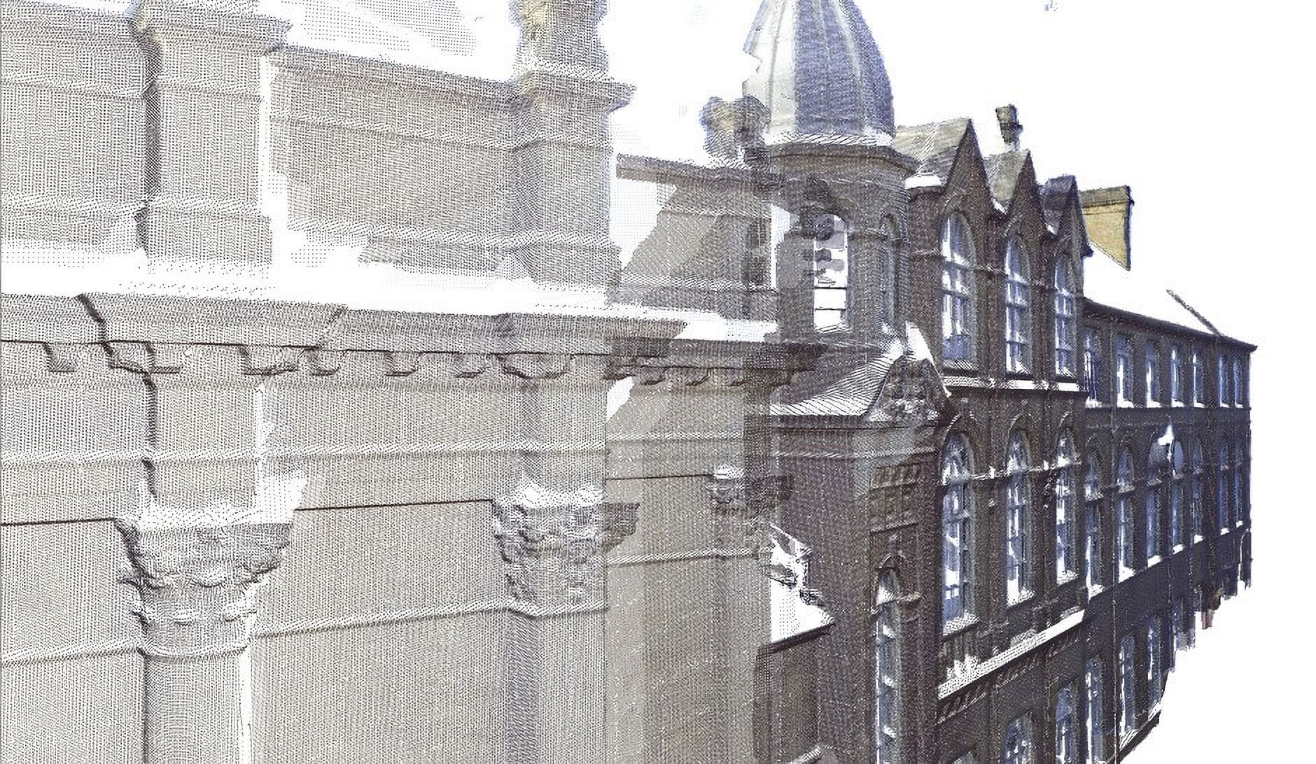
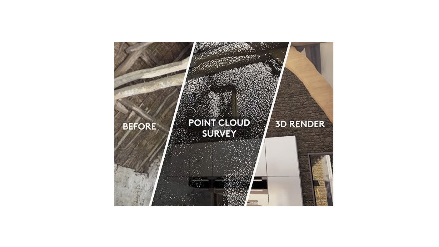
However, these intricate and often very delicate listed properties require much higher attention to detail than manual surveying and measurements are able to deliver. Which is why we now use 3D laser scanning (known as Point Cloud Surveys) instead.
Point Cloud Surveys gather all the necessary geometry information and accurate colour information of a building and its systems, including any ornamental features (no matter how intricate or small). As a result they dramatically reduce the amount time spent surveying properties, eliminate errors and improve accuracy.
How do Point Cloud Surveys work?
Point Cloud Surveys are fast becoming the industry norm for surveying buildings with a high degree of precision.
A Point Cloud Survey uses a laser to produce an internal and external scan of a building. The laser sends out millions of laser beams, which return points as they hit surfaces. Each point contains information (X, Y, Z coordinates) about the distance it has travelled, and an RGB (red, green, blue) colour code of the surface it has hit.
When you combine these points you get what is known as Point Cloud Data.
How Point Cloud Surveys evolved from topographical surveys to residential architecture
Point Cloud Surveys have been known for years as Geographical Information System (GIS), and were used to efficiently and accurately analyse all kinds of terrains.
However, the technology has recently been making a big impact in the architectural world, enabling innovative architectural firms like ours to cost-efficiently and accurately analyse a wide range of objects, from streets, buildings, and interiors to engineering details.
This new technology means that the days of the old fashioned, meticulous and expensive method of hand surveying are numbered.
How do you know if your project needs a Point Cloud Survey?
When you contact us to take on your project we’ll evaluate whether you need a Point Cloud Survey. This will depend on the brief and the type of building. We usually use Point Cloud Surveys for projects that involve modelling:
- Existing buildings before renovation.
- The surroundings before creating a new building.
- The ‘as-built’ structure to detect deviations from the plan.
How do we use Point Cloud Surveys at the project design stage?
Once we have received your Point Cloud Data, if your project needs it, we import it into ARCHICAD, software we use to transform the survey data into a Building Information Model of your home.
Once this is complete we can start the design process, using exact measurements of your home. These measurements give us a clear visualisation of the building, and enable us to align our renovation designs with accurate, as-built data.
This workflow also means we can create native, detailed models in a short amount of time. Being able to accurately inspect existing conditions in 3D removes much of the guesswork, particularly on heritage and renovation projects.
And, importantly, knowing more variables at such an early stage of the project reduces reworking and lowers costs later on.
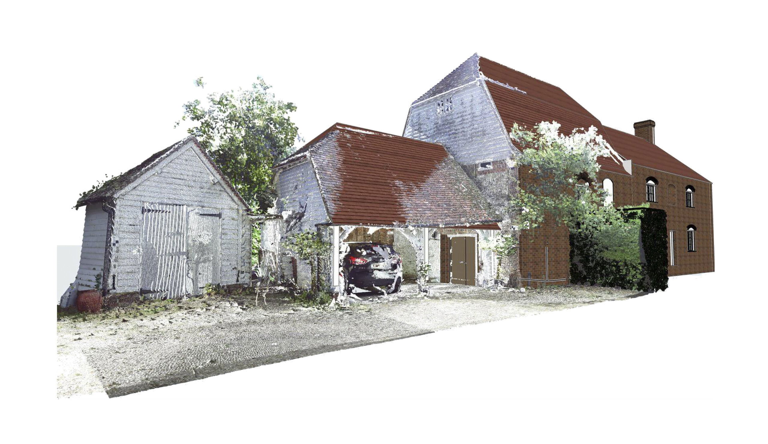
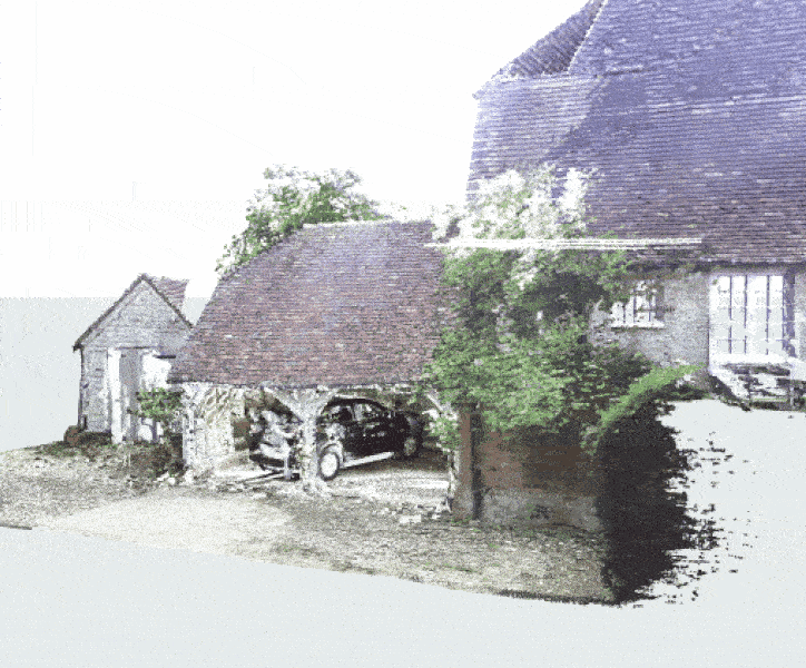
How we used a Point Cloud Survey on a 17th Century barn
A client recently asked us to carry out a conversion of a 17th Century barn. The barn was to be converted into large, double height kitchen with links to the garden. The client also wanted to create an annex from an attached pig shed with a corrugated iron roof.
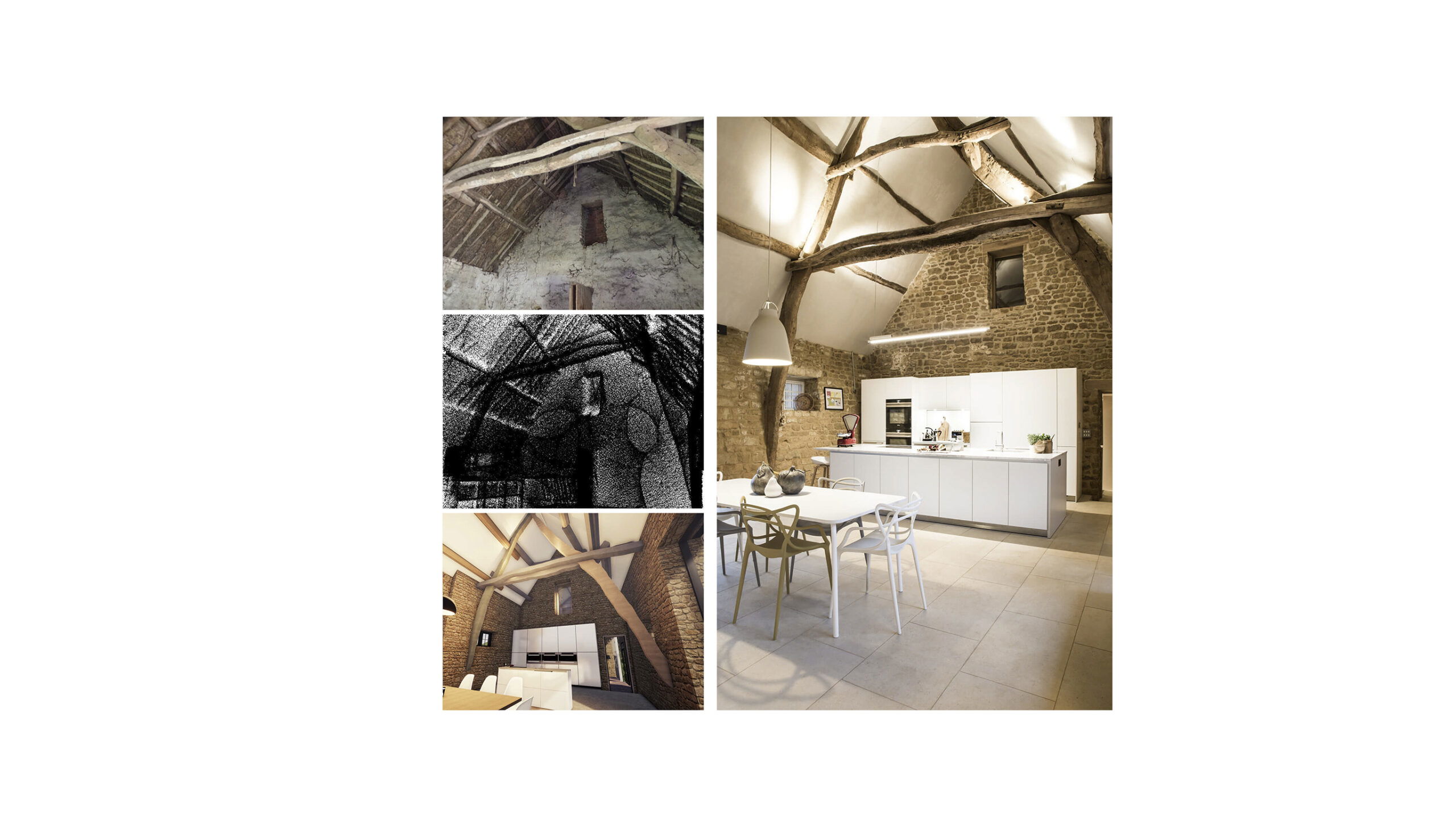
Using a Point Cloud Survey we were able to digitally capture every aspect of the 400-year-old oak frame. This allowed us to accurately model and sympathetically design the modern living space.
Being able to visualise the building in a virtual environment enabled us to test concepts and properly understand the full impact of the design and structural decisions we were making, before going to site.
How can we help you?
As a leading renovation architect we provide architecture services throughout London, Surrey, Oxfordshire, Buckinghamshire, Berkshire and the Cotswolds. We’d love to help you plan your sympathetic renovation. Find out more about how we work or get in touch for an initial meeting with Ben Holland or Stephen Green.